Community
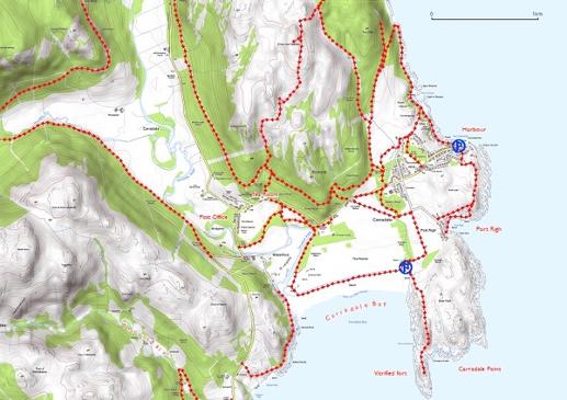
East Kintyre Walking & Running Maps
We are delighted to have wonderful downloadable maps for exploring the paths around Carradale, Torrisdale and Saddell, courtesy of Mapmaker.
To use the map links, please ensure you have Google Earth App dowloaded onto your computer or smartphone. Click on the KML button below to download the paths as a Google Earth KML file. Click on the GPX button below to download the paths as a GPX file. A GPX file can be used with various GPS devices as well as viewed in Google Earth.
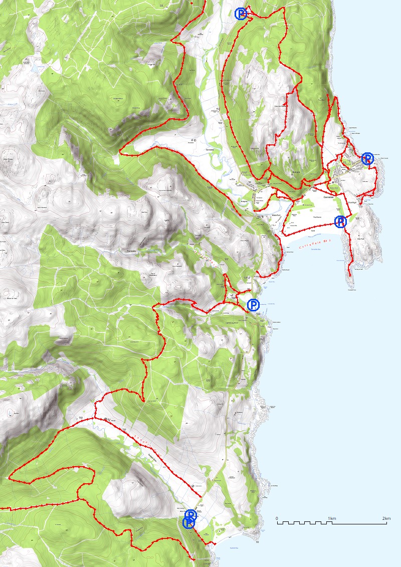
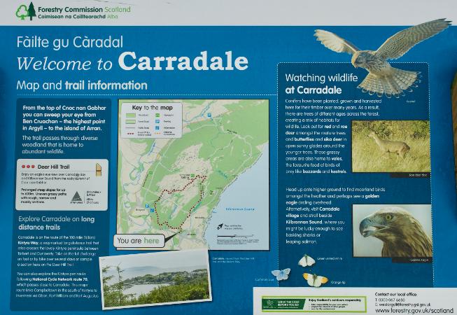
Cnoc nan Gabhar or Deer Hill, Carradale
Distance 5.75km / 3.5 milesTime1.5 – 2 hours
This way-marked forestry walk climbs to the summit of Cnoc nan Gabhar, to the north of Carradale. The reward is a stunning panorama, taking in much of the east coast of Kintyre as well as the Arran mountains and Ailsa Craig.
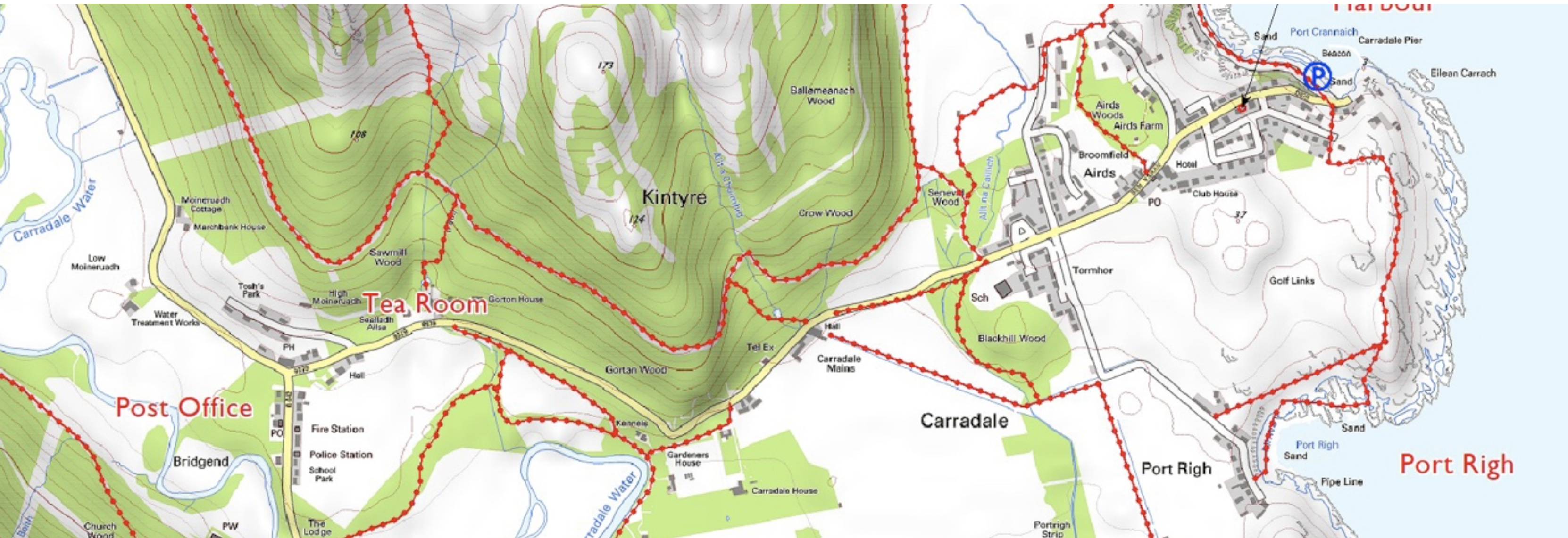
The Great Carradale Canter
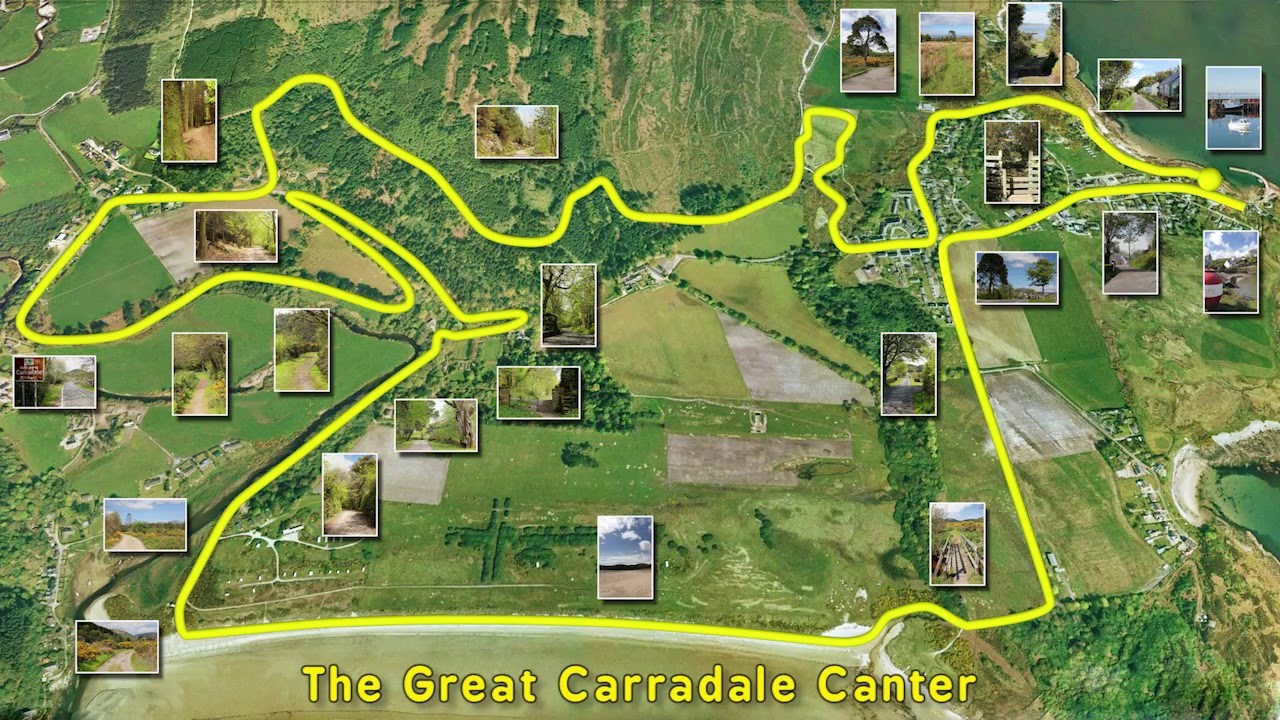
The Great Carradale Canter is an exciting 10k challenge, starting and finishing at Carradale Harbour.
The course enjoys a hilly start on the local roads before heading for Carradale Bay and then forest roads, finally returning to the village across fields to Shore Road and back to the Harbour. The event is held annually and so come along and have a go at the event.
Malcolm Trott of CHEL has kindly provided us with the map of the 10k route used each year for the Great Carradale Canter.
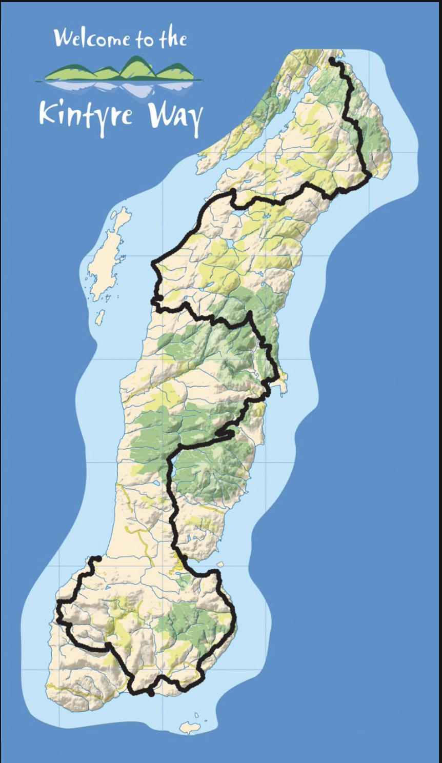
The Kintyre Way
This 100 mile (161 km) walk from Tarbert in the North to Machrihanish in the South, is one of Scotland’s newest long-distance routes and meanders down the Kintyre peninsula, connecting villages and showing off the landscape at its very best.
Along the Kintyre Way you will discover hidden coves, deserted beaches, woods and forests, castles and fishing villages, and an abundance of wildlife. The seven graded and way-marked sections offer a variety of walking terrain from serious hiking to gentle rambles.
A large section of the route goes through East Kintyre via Deucharan Hill, Carradale, Torrisdale and then Saddell as it heads to Lussa Loch.
